Nordic sports – Nordic walking
Nordic sports are in trend. Why? Because they are easy to learn and offer a gentle way to practise endurance sports. Dynamic movement during Nordic walking or cross-country skiing boosts both the immune system and the cardiovascular system and lowers high blood pressure.
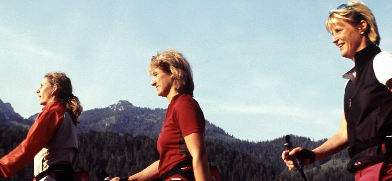
Nordic walking is the perfect sport for people with weight issues, people with minor joint problems and those just starting out. The training activates a large part of the human muscular system and burns calorie. Learning the right technique is important to avoid biomechanical stress and ineffectiveness.
The DSV Nordic Active Centre in Bayrischzell offers ideal conditions for Nordic walking and cross-country skiing, classic or skating. This healthy type of exercise in the fresh air is fun and keeps you fit. In Bayrischzell and the surrounding region, there are many routes that promise pure enjoyment for outdoor exercise - always with a view of the Bavarian Alps.
DSV Nordic Active training centre
The Tegernsee-Schliersee alpine region has been officially certified as a DSV Nordic Aktiv training centre in Bavaria by the German Ski Association since 2010. This verifies that the region has the perfect infrastructure for all things relating to Nordic sports, first-class courses, advanced training and excellent local support.
Whether it’s Nordic walking, Nordic blading, Nordic skiing, Nordic snowshoeing, running/trail running, speed hiking, mountain biking, trend sports (slacklining etc.), prevention or therapy - the DSV Nordic Active training centre in the Tegernsee-Schliersee alpine region offers everything you could wish for to enjoy Nordic sports.
The German Ski Association’s quality assurance ensures excellent facilities for all Nordic sports. Whether it’s cross-country skiing or Nordic walking – the routes and trails are well-signposted and groomed, offer changing and shower facilities on the trails, and the DSV organises first-class courses and advanced training. You can test the trails and routes in the DSV Nordic Active Centres in Bayrischzell, Schliersee and in the Tegernsee Valley for yourself. And while you’re here, why not joining a training session?
The training centre in Bavaria trains opinion leaders from the sports and health sectors such as trainers, physiotherapists and sports teachers. The equipment partner finds the opinion leader and the opinion leader finds the retailer. The training centre also serves as a contact for sports organisers and the media. It also has attractive offers for all sports enthusiasts.
Nordic walking & trail running
Running and skating in Bayrischzell
The Bayrischzell region is a paradise for runners. With 31 routes, amateur athletes and active holidaymakers have a range of trails to choose from. The 5 Nordic walking paths and 26 trail running routes lead through the Bayrischzell region and invite you to explore the Bavarian Alps. Here are a few highlights of the region:
Melkstatt tour - Nordic walking tour
Easy tour via Melkstatt-Tannerhof
From the Kurpark we continue through the village past the Edeka supermarket to the underpass. We emerge on the other side and walk along the Seeberg next to the largely dry Leitzach riverbed to the Schreyerbach Kneipp facility. Once there, we revitalise our bodies and let our souls dangle. The trail then continues to the main road and into the sparse Melkstatt forest. We then follow the path to Tannerfeld, from where you’ll have a beautiful view over Bayrischzell that extends to the Auracher Köpfl peak. Then we follow the road to the right into the village and will have arrived back at the starting point.
The Tannerfeldstüberl is a great place for a refreshment stop with a magnificent view.
- Difficulty: easy
- Distance: 3.5 km
- Duration: 1.00 h
- Ascent: 50 m elevaton gain
- Descent: 50 m elevation loss
Bayrischzeller Nordic trail - Nordic walking tour
A challenging Nordic walking tour that starts in the Bayrischzell Kurpark. The steep ascent at the beginning is rewarded with beautiful valley and panoramic views.
We start at the “Nordic-Aktiv-Zentrum Bayrischzell” info panel in the Kurpark. First, we turn left and cross the Larchbach stream. From this point on, we follow the black and white signs. We pass the Chapel of Mercy and an old sycamore maple, which is one of the oldest of its kind in the district. There is also a Kneipp facility on the right-hand side of the path. We leave the place during the subsequent steep climb. Our path now takes us across the Zeller Alm. Finally, we pass Bergcafé Sigel with a wonderful view of the valley. From Osterhofen, we walk parallel to the railway tracks back to Bayrischzell. There the path leads us over the waterfalls. We continue pass the lido, tennis courts and children's playground and return to the spa gardens.
- Difficulty: medium
- Distance: 6.9 km
- Duration: 2.0 h
- Ascent: 271 m elevation gain
- Descent: 271 m elevation loss
Osterhofen tour - Nordic walking tour
Medium level tour of Osterhofen. Relax and unwind in the valley.
From the Kurpark we head in the direction of the sports field and tennis courts. From there we walk along the Leitzach river in Bayrischzell out into the green meadows. Then we cross the first bridge over the Leitzach river and continue on a field path to the main road. We cross this and go in the direction of Siglhof, turning right after the railway underpass and returning to Bayrischzell alongside the railway line via an undulating path. In Bayrischzell we then head via Kranzer to the town centre and starting point.
- Difficulty: medium
- Distance: 5.8 km
- Duration: 1.15 h
- Ascent: 82 m elevation gain
- Descent: 82 m elevation loss
Hochkreuth tour - Nordic walking trail
Difficult tour via Hochkreuth
From the Kurpark via the König-Maximilian-Weg trail we walk to Hochkreuth and Osterhofen, then back along the railway embankment to the starting point.
- Distanec: 6.9 km
- Duration: 2.15 h
- Ascent: 244 m elevation gain
- Descent: 244 m elevation loss
Sportalm Bayrischzell - Soinsee - Rotwand - Taubenstein - trail running circuit
A quite challenging mountain run, but it has many beautiful elements and takes you primarily along forest roads.
The ascent to the Sillberghaus alpine inn is quite challenging at the beginning, so we recommend taking the forest road. From kilometres 4 to 14.5 it goes steadily uphill, with short flat or slightly descending sections - overall a pleasant walk. Short, easy climbs are required particularly below the Ruchenköpfe peak, so it is advisable to go along the lake at Soinsee, then via Großtiefental valley to Kleintiefentalalm or take the worthwhile route via Rotwandhaus, Mt. Taubenstein and Taubensteinhaus, and then take the forest path downhill. The trail from Rotwandhaus to Mt. Taubenstein is another nice walk - it's nice to be at the top! On Mt. Taubenstein, you again have the option of taking the trail here down to the Kleintiefental Alm or via Taubensteinbahn station and Taubensteinhaus to the forest road. The latter is more suitable for runners. The trail from Taubenstein to Kleintiefental valley is more suitable for walking than running. Then it goes continuously downhill with consistently steep farm roads and wonderful wooded areas.
The last 6 km are flat towards the Sportalm - perfect for the final stage of your run. The route has a total of 27 km and about 1,000 m in elevation change. Showering is possible at the Sportalm, where delicious cuisine awaits.
- Difficulty: medium
- Distance: 27.6 km
- Duration: 4.30 h
- Ascent: 1,551 m elevaton gain
- Descent: 1,538 m elevation loss
Kleinmiesing, Aiplspitz and Jägerkamp - trail running circuit
From Geitau, the trail takes you to the Krottentaler Alm on a forest road, then on a mountain path, which is rough in parts. From Benzing-Alm there is a wider path again. About 3/4 of the route can be run quite well, but the forest road is very steep from Mieseben to the junction to Krottentaler Alm. The greatest difficulty is probably running past the Cafe-Restaurant Krugalm shortly before the end of the tour.
Tip:
Option: Arrive with BOB tain to Geitau, back via Fischbachau.
Ascent variant: From Geitau via Angelalm to Heubergsattel, this path is much steeper and probably hard to run.
- Difficulty: medium
- Distance: 22.6 km
- Duration: 4.31 h
- Ascent: 1,166 m elevation gain
- Descent: 1,169 m elevation loss
Aiplspitz Rotwand Auerspitz - trail running circuit
Panoramic summit tour of Aiplspitz, Rotwand and Auerspitz, with a lot offer!
Panoramic summit tour that has a lot to offer: from the forest road and smooth hiking trails to trails with roots to easy climbs. On clear days you will be rewarded on this tour with a view of the Zugspitze, Mt. Wendelstein, Lake Chiemsee, Lake Schliersee, etc. Between Mt. Taubenstein and Rotwandhaus, the route is more frequented on the wider hiking trails due to the gondola service.
Tip:
The tour can be extended by a few metres of elevation gain with a stop on Mt. Hochmiesing - this way you don't go back the same way.
- Difficulty: medium
- Distance: 24.3 km
- Duration: 4 h 30
- Ascent: 1796 m elevation gain
- Descent: 1799 m elevation loss
